姓 名:王渊 | 学 历:博士研究生 | 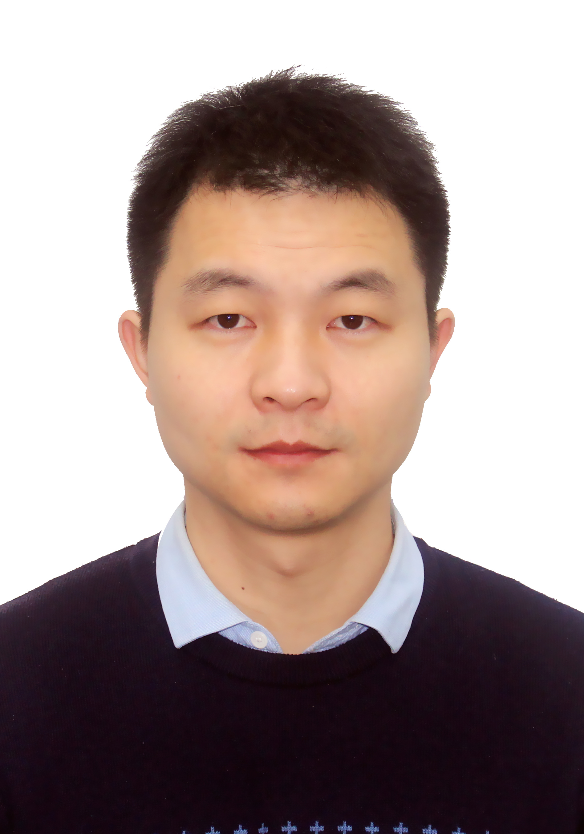
|
专 业:摄影测量与遥感 |
个人主页:https://scholar.google.com/citations?hl=en&user=yvQpME4AAAAJ |
邮 箱:wangyuanwhu@jxnu.edu.cn |
职务、兼职、荣誉称号
2023.07-至今 江西师范大学地理与环境学院
2023年至今 IEEE ITS、IEEE TGRS、JAG、JSTARS、The Photogrammetric Record等期刊审稿人
2025 中国测绘学会文化遗产保护专业委员会委员
2026 中国测绘学会青年工作委员会委员
主要教育经历
2018.09-2022.12 武汉大学 测绘遥感信息工程全国重点实验室 摄影测量与遥感 博士 导师:杨必胜教授
2015.09-2018.07 湖北大学 资源与环境学院 地图学与地理信息系统 硕士
2009.09-2013.07 合肥工业大学 数学学院 数学与应用数学 学士
主要研究方向
遥感与GIS前沿应用、多模态数据融合、点云数据智能处理及其在文物数字化保护、智能交通、低空经济、数字孪生等应用
欢迎数学、计算机、测绘、遥感、GIS等专业学生加入研究队伍
主要论文、论著
[1] Chen, Y., Chen, S., Sun, P., Dong, Z., Wang, Y.*, Zou, X., Zhu, J., and Lin, H. (2026). DifferAugNet: Multi-Scale Feature Aggregation and Differential Feature Augmentation for Remote Sensing Image Change Detection. IEEE Journal of Selected Topics in Applied Earth Observations and Remote Sensing. (中科院二区)
[2] Wang, Y., Sun, P., Chu, W., Li, Y., Chen, Y.*, Lin, H., Yang, B., Dong, Z., and He, C. (2024). Efficient multi-modal high-precision semantic segmentation from MLS point cloud without 3D annotation. International Journal of Applied Earth Observation and Geoinformation, 135, 104243. (中科院一区Top)
[2] Wang, Y., Li, Y., Chen, Y.*, Peng, M., Li H., Yang B., Chen C.* and Dong, Z., (2022). Automatic registration of point cloud and panoramic images in urban scenes based on pole matching. International Journal of Applied Earth Observation and Geoinformation, 115, p.103083. (中科院一区Top)
[3] Wang, Y., Yang, B.*, Chen, Y., Liang, F. and Dong, Z., (2021). JoKDNet: A joint keypoint detection and description network for large-scale outdoor TLS point clouds registration. International Journal of Applied Earth Observation and Geoinformation, 104, p.102534. (中科院一区Top)
[4] 王渊. (2024). 车载激光点云数据增强与语义分割. 武汉大学学报 (信息科学版), 49(10).
[5]Li, Y., Li, J., Dong, Z.*, Wang, Y., Yang, B.* (2025). SaliencyI2PLoc: saliency-guided image-point cloud localization using contrastive learning. Information Fusion, 103015. (中科院一区Top)
[6] Duan, Y., Chen, M., Liu, Y., Wang, Y., Zhang, L. (2025). Research on the cultural landscape features and regional variations of traditional villages and dwellings in multicultural blending areas: a case study of the Jiangxi-Anhui junction region. Applied Sciences, 15(4), 2185.
[7] Chen, Z.*, Chen, Y.*, Wang, Y., Wang, X., Wang, X., Wang, X. and Xiang, Z. (2024). DCFF-Net: Deep Context Feature Fusion Network for High-Precision Classification of Hyperspectral Image. Remote Sensing, 16(16), 3002. (中科院二区)
[8] Hu, Q., Wang, Y., Wang, Y., He, C.* (2024). The dynamic evolution characteristics of PM2. 5 concentrations and health risk assessment during typical forest fires in China. Atmospheric Pollution Research, 15(12), 102303. (中科院三区)
[9] Zou, X., Li, J.*, Wang, Y., Liang, F., Wu, W., Wang, H., Yang, B. and Dong, Z. (2023). PatchAugNet: Patch feature augmentation-based heterogeneous point cloud place recognition in large-scale street scenes. ISPRS Journal of Photogrammetry and Remote Sensing, 206, 273-292. (中科院一区Top)
[10] Li, Y., Zou, X., Li, T., Sun, S., Wang, Y., Liang, F., Li, J.*, Yang, B.* and Dong, Z. (2023). MuCoGraph: A multi-scale constraint enhanced pose-graph framework for MLS point cloud inconsistency correction. ISPRS Journal of Photogrammetry and Remote Sensing, 204, 421-441. (中科院一区Top)
[11] Huang, C., Chen, B., Sun, C., Wang, Y., Zhang, J., Yang, H., ... & He, C. (2023). Synergistic Application of Multiple Machine Learning Algorithms and Hyperparameter Optimization Strategies for Net Ecosystem Productivity Prediction in Southeast Asia. Remote Sensing, 16(1), 17. (中科院二区)
[12] Ji, X., Yang, B.*, Wang, Y., Tang, Q., and Xu, W. (2022). Full-waveform classification and segmentation-based signal detection of single-wavelength bathymetric LiDAR. IEEE Transactions on Geoscience and Remote Sensing. (中科院一区Top)
[13] Zhu, R., Liu, Y., Dong, Z., Wang, Y., Jiang, T., Wang, W. and Yang, B.* (2021). AdaFit: Rethinking Learning-based Normal Estimation on Point Clouds. In Proceedings of the IEEE/CVF International Conference on Computer Vision (pp. 6118-6127). (CCF-A类会议)
[14] Dong, Z., Liang, F., Yang, B.*, Xu, Y., Zang, Y., Li, J., Wang, Y., Dai, W., Fan, H., Hyyppä, J. and Stilla, U., (2020). Registration of large-scale terrestrial laser scanner point clouds: A review and benchmark. ISPRS Journal of Photogrammetry and Remote Sensing, 163, pp.327-342. (中科院一区Top)
科研项目
1. 国家自然科学基金青年项目,2026.01-2028.12,综合多模态数据的复杂交通路口动态目标实时精准感知,主持
2. 国家自然科学基金地区科学基金项目,2026.01-2029.12,融合多模态遥感数据的亚热带森林林火干扰后地上碳储量恢复模式与驱动机制研究,参与
3. 江西省自然科学基金面上项目,2025.09-2028.09,基于LiDAR和机器视觉融合感知的矿山地下开采空区安全风险动态评估,主持
4. 江西省自然科学基金青年基金项目,2024.06-2026.05,基于多模态数据融合的交通路口要素结构化提取,主持
5. 武汉大学测绘遥感信息工程国家重点实验室开放基金,2024.01-2025.12,车载激光点云与影像高精度配准网络模型研究,主持(已结题)
6. 江西师范大学博士启动基金,2023.07-2028.07,主持
7. 江西省重点研发计划项目,2026.01-2029.01,江西传统村落文化古籍的数字化及应用研究,参与
8. 江西省重点研发计划项目,2025.01-2027.12,天-空-地联合观测的公路边坡地质灾害智能识别与监测预警关键技术研究,参与
9. 国家杰出青年科学基金,2018.1-2022.12,广义点云多细节层次三维建模理论与方法,参与
发明专利/软著
1. 一种基于共轭杆基元查找的点云与全景影像精配准方法(2026). 专利号:ZL202311255654.4
2. 遥感图像变化检测方法、装置和电子设备(2025). 专利号:ZL202510386799.
3. 一种高光谱小样本分类方法、系统、设备及介质(2025). 专利号:ZL202510000248.6
4. 一种基于图注意力的公路边坡地表位移时间序列预测方法(2025). 专利号:ZL202511073446.1
5. 一种结合江豚栖息地模拟的河域环境优化方法及系统(2025). 专利号:ZL202510177046.9
6. 一种无需标注的车载激光点云高精度语义分割方法及系统(2024). 专利号:ZL202410719295.1
7. 空间形状信息表达与识别软件(IRSS) (2015). 登记号:2015SR148767
个人荣誉
1. 2025年 地理信息科技进步二等奖(4/12)
2. 2025年 指导学生获易智瑞杯中国大学生GIS软件开发竞赛(地图故事组)国家三等奖
3. 2024年 江西师范大学地理与环境学院教师教学创新大赛三等奖
4. 2023年 上海市测绘科技进步二等奖(3/15)
联系方式
通信地址:江西省南昌市紫阳大道99号
办公地点:江西师范大学瑶湖校区方荫楼2区(地理与环境学院)
邮 编:330022
